Wednesday, December 30, 2015

Brasilia to Rio De Janeiro (SBBR - SBGL)


Rio De Janeiro
Rio de Janeiro/RIOgaleão–Antonio Carlos Jobim International Airport, popularly known by its original name Galeão International Airport, is the main airport serving Rio de Janeiro, Brazil. It is the country's second-busiest international airport.


Sunday, October 4, 2015

Manaus to Brasilia (SBEG - SBBR)


Basic Brasilia 


I had opted for the standard FS scenery for Brasilia. Unfortunately I seemed to have caught a bug on this leg of the trip.

Friday, August 28, 2015

Willemstad Curacao - Manaus Brazil (TNCC - SBEG)


Flying the NightEye
Catching the late flight off this island to Brasil. Insel operate a two flights a week to the city of Manaus that sits along the Rio Amazonas (Amazon river?). The only direct flights are onMonday and Friday at 20:50 getting into Manaus just before midnight. Took off about 10minutes behind schedule into pitch blackness. Finding my way to the end of runway11 at Willemstad for take off was challenging when the aircrafts landing lights failed. This  (MD80) mad dog has been a real pain to fly and I will be more than happy to abandon her at the first gate I find at SBEG, The engineers can spend all the time they want trying to find lighting fault. So as not to delay any further I opted for pushback and clearance, there shouldn't be any need to tell the passengers? The take off became even more challenging when I battled with the auto pilot to get the nose up out of  the climb. The first time I had an oppertunity to look out of the window I was crossing the Orinoco river and  briefly skirting along the Venezuelan and Colombian borders. Airtraffic was very quiet at this time of night, not much traffic about. However I was joined by N22600 a B747 flying parallel that was a Global freight from Denver to Rio De Janeiro  (I thought I had disabled all FSX AI traffic??).

Reliesed needed more speed to catch up as I'm now scheduled to arrive after midnight


Saturday, August 8, 2015

Port Au Prince to St Maarten (MTPP-TNCM)


Carefree Caribbean
This leg has to be the one that I have been looking forward to for some time. The anticipation of clipping the tops of beach umbrellas before touching down on this iconic runway has been one of my main goals to be achieve on this around the world trip. In preparation for the flight I have taken up a position with Insel Air and was eager to operate their scheduled flights between Haiti and St Maarten, wearing the Insel Air colours. When finally given clearance to fly  the Saturday scheduled flight, I had to return to Port Au Prince 30minutes later, after a drastic loss in altitude when the autopilot disconnected. This meant another long delay in Haiti as new parts where shipped in for the failed unit. It would be another few weeks before I could make the flight again.


Sunday, June 28, 2015

Miami to Port Au Prince (KMIA-MTPP)


Hello Haiti 

American Airlines are allowing me to captain a scheduled flight to Haiti. This is the last charter I will be doing for the Airline for some time and I think they will be happy to get me out of their hair. When I get to Haiti I'm going to look around for another charter company to take me further. The flight was reasonable (read: it took me two attempts) and I'm finally starting to get to grips with this MD80 (not really).

Monday, May 25, 2015

Washington to Atlanta (KIAD - KATL)


Hartsfield–Jackson Atlanta International Airport, known locally as Atlanta Airport, Hartsfield, or Hartsfield–Jackson, is located seven miles south of the central business district of Atlanta, Georgia, United States


Sunday, May 24, 2015

New York to Washington (KJFK - KIAD)

Capital Run


Leaving JFK in a brand new Airbus A320IAE for Washington. This flight is a scheduled Jet Blue service. My confidence and ability in flying the Airbus has final started to show. I have taken the decision to start replicating existing scheduled flights between cities and stick as close to the scheduled time as possible.
Airport Scenery
JFK and Washington DC Dullas (KIAD) are a Jet Blue Hub, with regular scheduled flights. The scenery was from imaginesim and is fairly reasonable. First released in 2008 it has a hint of being dated when compared with more recent designs. Something that is striking about this scenery is the odd shaped "mobile lounges" that lap the airports aprons at a frequency that is a bit unrealistic. One "mobile lounge" followed by a van , repeat, repeat, repeat.

The Route
My routing was  KJFK/ DECKR/HEROS/KTEB/ FALLZ/62NJ/ KLNS/DELRO/ MULRR/ KIAD. Probably one of the best approaches flown yet. Arriving from the north, the approach path had me complete a base leg to set me up for a perfect touch down with perfect visibility.

Weather
The weather over the states has been great the last few weeks. Heavy storms have caused some flooding but have not touched the east coast yet.

AI Traffic
UPS flights out Washigngton


Sunday, May 17, 2015

Boston to New York (KBOS - KJFK)

The Big Apple, small plane


Big apple . .here we come. The screen shot above is  me departing JFK later that week, after switching airlines and upgrading to the Airbus A320. Good old G-EUPH had done well to bring me this far, but now it was time to upgrade. JFK is where I will be leaving the British Airways A319 and taking up captaincy with Jet Blue. I've been looking forward to arriving in the big apple for some time and had been slowly  collecting scenery to add to the flight. In my collection was New York City X, a monster of an addon with autogen around Manhattan island popping up everywhere. Unfortunately this would kill the frame rate on my computer at sometime.


Airport Scenery
New York Airports X by Drzewiecki Design was the scenery I used for this New York visit. The Canarsie STAR approach using 13L is well depicted with the airport runway lights starting along the freeway and on top of the roof of the nearby hotel.  JFK is big  with well marked taxiways, unfortunately I still got lost and battled to find my gate

The Route
My routing was   KBOS/BRUWN/ACK/SEY/ PARCH/ CCC/ ROBER/ KFK. An uneventful trip down with the highlight definetly being the Canarsie approach. Watch this Youtube clip to see how the pro's fly the approach.

Charts
www.uk.flightaware.com  (KJFK) has started to become the first place I look for Charts

AI Traffic
Air Canada Jazz blocking the taxiway. Am I on the wrong taxiway or him? Once again some marvolous AI. However I should have spend more time loading a few more airlines as I could have had the airport a bit busier. 


Sunday, May 3, 2015

Quebec to Boston (CYQB - KBOS)

Boston Bound


After a short detour up into Canada it was time to head southwards back over the border towards Boston. Doing some research I found a few YouTube clips showing  an impressive approach into Boston, lining up on 04L with an impressive city landscape off the left wing. This clip shows a great approach over the top of the harbour. http://youtu.be/tuNXAFBmO90. I really had my heart set on an easterly wind for my arrival and having this approach lined up for me. Sadly not.


Airport Scenery
General Edward Lawerance Logan International Airport (KBOS). This add on is from the Fly Tampa stable but distributed by Aerosoft . I ordered a box copy for delivery and after a week it arrived. Instillation was pretty straight forward and its difficult to go wrong. Surprisingly good layout of the area surrounding the airport.


The Route
I departed Quebec on 06 before making a right hand turn towards PESVI. The SIDS where pretty basic.

My routing was  CYQB / PESVI / KELBO/ YSC/ MPV/ LEB/ SEETS/ KBOS. It was a left turn at SEETS and then a step down approach into Boston using the QUABN three arrival STAR, This is a handy arrivals chart to fly by as the step down in altitude and speeds are clearly marked , only that I do need to work on slowing everything down during this phase.

Charts
I was disappointed that the Boston Mega Airport box set does not come with any charts and that I had to go online to find anything. Charts from www.uk.flightaware.com  (KBOS)

The Flight
The weather has been nice and clear, but I'm starting to get a few gremlins creeping into the system. The ASN keeps loosing connection with FSX.

AI Traffic
AI traffic made life a bit difficult. Thanks to a departing Delta taking his time on the treshold I had to go around. Pretty sure if this was real life I would be the one being called into the office to explain . . left it a bit late.


Saturday, May 2, 2015

Halifax - Quebec (CYHZ - CYQB)

Le De'tour Quebec


This leg is a detour off the original path. A detour purely so that I can have a look at some of the Canadian countryside and to stop in at the Jean Lesage International Airport before crossing the border into the states. I want to get some milage out of the UTX Canada terrain I've purchased. I had originally downloaded CYQB as an alternate to Halifax should I have needed to divert on the previous leg. The airport look so good, that I thought it would be a shame not to visit.


Airport Scenery
Quebec/ Jean Lesage International (CYQB) is a great little gem on the Flightsim.com site. This airport has only had over 2000 free downloads since 2012 which was a surprise for such a nice addon. One of the little touches I liked was the nearby arial mast with flashing beacons. The interior of the airport is well designed with departure halls and display screens. For a free addon, you must get this airport if you are passing by. Well done Gilles Boily!!

The Route
A short flight with very little to mention along the route. (As a side note:, I'm beginning to wonder if I've even loaded the UTX Canadian scenery? . . can't see any major change from the default FSX scenery?) .

My routing was  CYHZ/ ARDEE/ YSJ/ MOWN/ HUL/ VLV/ROGSA/CYQB. Approach was from the south of the airport for 06L.

The weather has started to clear up and no more angry clouds abouts..

Charts
Charts from www.IVAO.ca  (CYQB)

The Flight
The weather has been great. It was a clear approach down into CYQB.


AI Traffic
I have been downloading a few regional Canadian airlines with the hope of seeing them enroute. Airlines like Porter Air, Sun Wing. Unfortunately when I landed in Quebec none of them where scheduled. I had a TUI charter by CanJet and a few Air Canada Jazz aircraft for company at the gates.


Tuesday, April 28, 2015

Narsarsuaq - Halifax (BGBW - CYHX)

Welcome to Canada


Final made it across to Nova Scotia. I had a few false starts a month ago and ended up spending more time than I actually wanted in Greenland. During those weeks I have seen the subtle signs of spring begin to creep northwards and melt the polar caps. It seems strange that in a months time I'm hoping to be on the southern side of the equator.


Airport Scenery
Halifax (CYHX) is from Simaddons.com and cost me about (£15) Can$19.99.  Its my first from them and I'm suitable impressed. The details good. Although it was dry when I landed, the water reflection off the apron was probably a bit to much at times for me, (but I think that could be my settings from the frictionality addon). I had a low ceiling of 1000ft and did not have time to appreciate the surrounding landmass when I touched down. Simaddons Halifax has independent jetways so no need for AES . . . but they are incredible noisy and in need on some grease!!


The Route
I think this has to be one of the longer routes I have yet flown. Close on four hours after having to do a go around at once after aborting on finals at Halifax.

My routing was BGBW/ CYMH/ YAY/ YDF/ YJT/ YQY/ CYHZ. The longest stretch being across the straight to Mary's Harbour (CYMH)

The weather was pretty good with a front just after hitting the Canadian mainland. The seatbelt sign was only on for a few minutes ans I don't think anybody spilt any drinks. My of the leg down NewFoundland was above a carpet of cloud that got a bit heavier approaching Halifax.

The Flight
I had loaded UTX Canada in the hope of seeing some incredible landscape below me. I was a bit disappointed as this was pointless at FL380 and cloud cover

Charts
Charts from www.IVAO.ca  (CYHZ)


AI Traffic
The skies have been pretty quiet around me for the last few legs. But now, as I'm approaching the North Americas, things are starting  to get a bit busier. One or two rapid changes in altitude  prevented us banging into the other travellers on this Atlantic crossing freeway. Delta seemed intent on making life a bit nerve racking for my passengers. Where ever it was they where going . . they where going there in a straight line!!" BA4045 . . please expedite your climb to FL380!!"


Sunday, March 15, 2015

Keflavik to Narsarsuaq (BIKF - BGBW)

The Green, Green land of Greenland.


I'm not going to exagerate, but I'm glad to see the back end of that old girl they call Iceland and Keflavik airport. I hope she does not take this personaly, but her firey temper, and lack of patients makes her one of the most hostile destinations in this FSX world. She showed no mercy to this novice pilot! I managed to raise my gear and sneak out the back door before she kicked up another storm.

This is the fourth leg of the Aerosoft Around the World challenge and Keflaviks' temperament has left me a week behind the rest of the party, now already in Greenland. If all goes well, I should be joining them today.

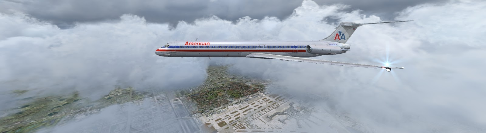
The flight across was probably one of my best. The approach into BGBW was impressively timed as I dropped through a brief, clear window in the sky for a great landing. ASN weather was being kind to me. Best landing yet!!


Airport Scenery
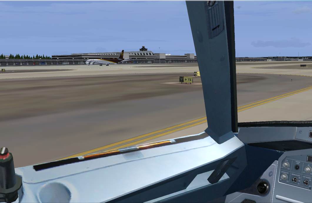
(BGBW) I downloaded the free scenery from FlightSim Greenland. You MUST have this scenery if you are even thinking about touching down in Greenland . Narsaruque sits at the base of some very impressive mountains that the default FSX scenery just does no justice to. Some great modelling work by the FlightsimGL team!


The Route
I'm not to sure that this would be a legitimate route. But I followed a high level airway UT594 before making a left turn down to W57 Would a real airline fly direct?

My routing was BIKF/ GIMLI/UT594/SOSIT/ DEVNU/ Intersect W57/KAYAK/ BGBW

The weather got better flying over Greenland with some impressive scenery. Managed to get down onto the ground before some snow started to fall.


The Flight
Only 30 pax and a cargo of 11318Kg. The total blocktime was 2hrs39. I took off at 08:43am local time (8:42GMT) and landed 08:21am (11:21GMT). Not to bad as I was only 15minutes behind my scheduled time.  


AI Traffic
I wasn't expecting much traffic along this route. Air Greenland offers a few flight to Narsarsuag, but nothing direct from Keflavik. If you wanted to book this flight online  it would be a 1,  2 or three stop layover taking 18-24 hours. Good thing I organised this charter.


Charts 
I battled to find any GOOD arrival charts for BGBW. What I did find, didn't show the 2500 foot mountain that suddenly appeared out of the cloud on my approach. I'm pretty sure its a new feature (or I had the map upside down . . )? Some big Mountains, I need a better chart . . or glasses.


Friday, March 13, 2015

Glasgow to Keflavik (EGPF - BIKF)

The Land of Ice, Fire . . . and electrical storms.

A"long haul" across the frozen straight to Iceland. This week has seen a steady set of rolling storms howl across this stretch of icy sea. High winds battering any aircraft making the crossing. On both attempts, wind sheer and electrical thunderstorms over Keflavik, threw up a few spanners, into the works. A "flame out" of number one engine on approach made things a bit more exciting. Only this time, I was able to get the engine restarted, . . . unlike the day before. Unfortunately there is no step by step procedure guide for what to do, that I could find? Things did not end that great, and I believe Keflavik airport must have been shut for the day after as they removed the wreckage.  Originally I had set the incidents for an emergency to occur during my "AtW" to 1%.What's the odd that I would have a similar procedural emergency on the second attempt of EPGF to BIKF?
Note: In total I ran this route four times before making it in one piece.


Airport Scenery
(BIKF) Keflavik International Airport. A bit of a bleak landscape with little surrounding vegetation. It would appear that the airport is on a peninsular with Reykjavik a few miles to the north. I think FSX Iceland is lacking some imaginary scenary building. This airport was from Aerosoft and part of their "AtW" discount download and integrates nicely with AES.   


AI Traffic
BIKF is home to Icelandair. On the WoAI schedule (summer 2014) that I downloaded, there was a 13H05 departure from Glasgow to Keflavik. But if you go on to the airlines website I could only find flights departing from Gatwick. They must suspend EGPF flights in the winter??
WoAI Icelandair from AVsim


Charts 
I got the BIKF AIP charts off the Aerosoft download. Not much to go on about. STAR and SID are basic.


THE FLIGHT PLAN
TimeNotes


The Planning: I kept the departure time to 13H25 with a scheduled arrival for 15H30. The flight was suppose to take just over two hours, but I ended up 54 minutes late due to weather and inflight emergencies.


The Route: EGPF/ LOMON/ STN/ RATSU/ BREKI/ BIKF

Departed EGPF:  Rwy 23 SID LOMAN 3A

Arrivals BIKF:  STAR via BREKI
Rwy 20 ILS


The Weather: Thor, the god of thunder, waiting to greet all new arrivals. Dodging storm cells at FL35 was still a very bumpy affair. Vomit bags are freely available in the front of your seat. The seat belt light will remain on for this flight!